Taxi platform · Sydney, Australia
15.8 million Australian addresses, and no Google Maps API bill
Rigzie is a taxi booking app in Sydney. Exicube built its maps to run on Rigzie's own server: address search, routing and the map itself.
- Client
- Rigzie, Sydney
- Live
- Since May 2026, on the App Store and Google Play
- Built
- Rider app, driver app, web booking, admin and booking desk
Drop-off · Sydney Zoo33.7885° S 150.8659° E
Pickup · Sydney Airport T233.9461° S 151.1772° E
15.8 million
street addresses in the search, from Australia's national address file, all states
178,000+
named places from OpenStreetMap, such as airports, hotels and venues
42.3 km
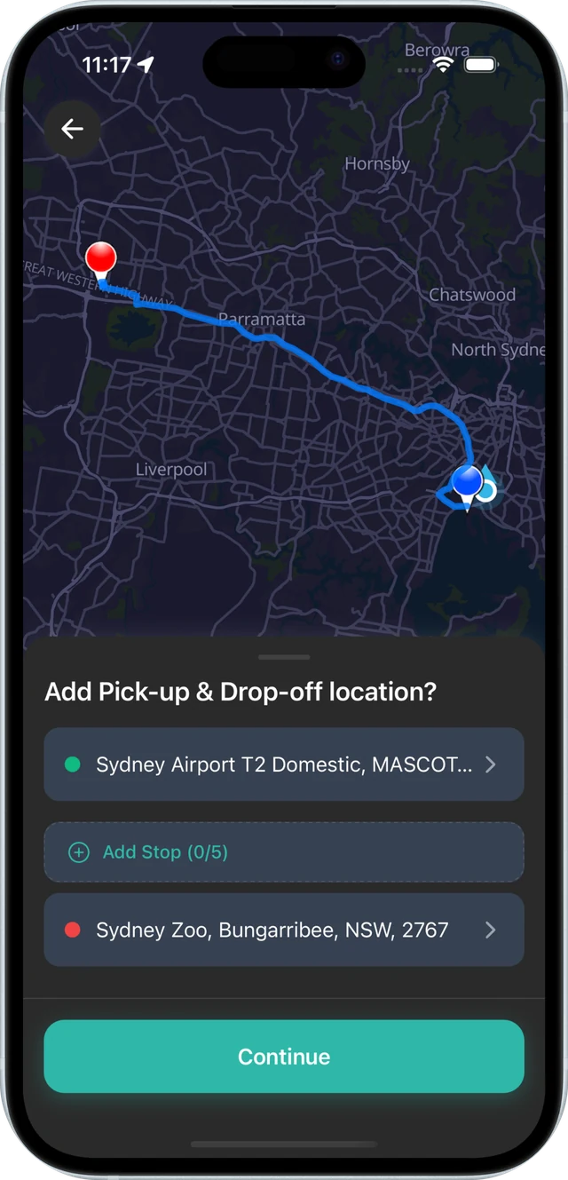
and 34 minutes from the airport to the zoo, worked out by the operator's own routing engine
One server
in Sydney runs search, routing and map tiles together
Every booking starts with an address
Rigzie puts every kind of taxi into one booking app for Sydney: sedans and SUVs, premium cars, wheelchair-accessible, baby-seat and pet-friendly taxis, maxi taxis for seven or eleven people, and mini-buses. Riders book in the app or on the web. Drivers work from their own app. The office takes phone and web bookings on a desk built for it.
Each of those bookings runs the same three steps. The rider types a pickup and the system finds it. The system works out the route, and the fare with it. Then every screen in the trip shows a map. A hosted map platform charges for each step, so the bill grows with every search, every quote and every map on a screen.
For Rigzie we moved all three steps onto the operator's own server.
Three jobs behind one gateway
The apps talk to one service, the Exicube maps gateway. Behind it sit an address database, a routing engine and a tile server. Each is open source or built on open data.
Finds the address
Address database in PostgreSQL. G-NAF national address file, OpenStreetMap places, and the operator's own places.
Works out the trip
Valhalla routing engine. The OpenStreetMap road network for Australia.
Shows the map
Tileserver-GL, drawn with MapLibre. Vector tiles built from OpenStreetMap, in a light and a dark style.
The address the rider actually means
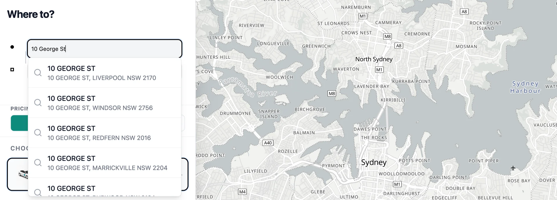
Type a street number and a street name, and the list comes back with real addresses, each with its suburb and postcode. There is a 10 George St in Liverpool, in Windsor, in Redfern and in Marrickville, and another in Beenleigh in Queensland. The rider picks the right one, and the booking carries its exact coordinates.
The addresses come from G-NAF, Australia's national address file, loaded into a database beside the app. Places people ask for by name, such as Sydney Airport T2 Domestic or Sydney Zoo, come from OpenStreetMap and appear in the same list.
Some pickups are in no national file yet, such as a depot, a loading bay or a new estate. The operator adds these in the admin panel. They are stored apart from the national data, so a data refresh never removes them.
- First build
- Search ran on OpenStreetMap alone. It knows streets and places well, but it does not hold every house number.
- Apr 2026
- Search moved onto the national address file, for the exact door.
- Aug 2026
- Coverage went from New South Wales to every state.
The distance and time behind every fare
Routing runs on Valhalla, an open-source engine, over the OpenStreetMap road network for Australia. It returns the route line, the distance and the driving time.
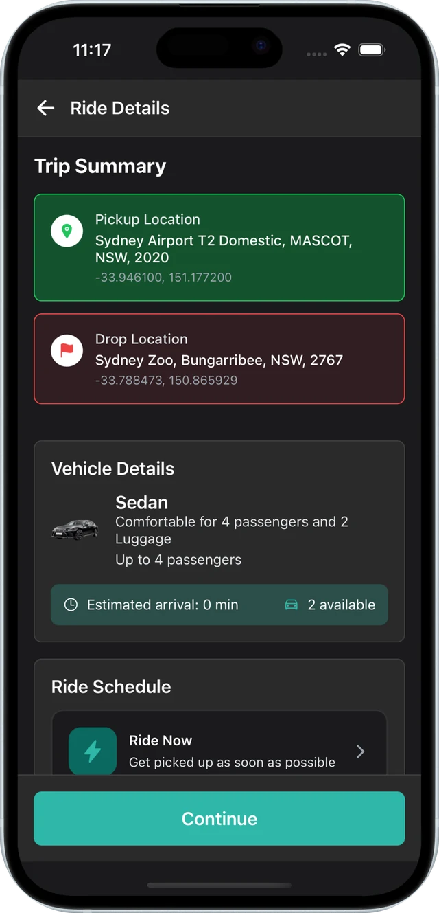
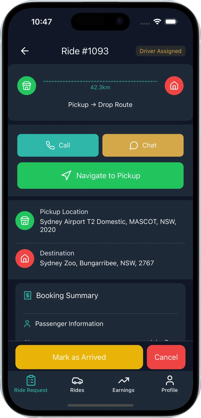
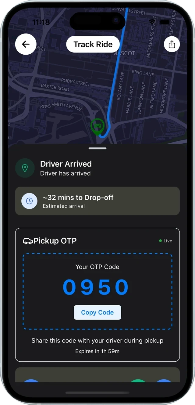
Those figures sit behind the fare quote and appear on every screen of the trip. From Sydney Airport T2 Domestic to Sydney Zoo, the web booking page, the rider app and the driver app all show 42.3 km and 34 minutes.
When the driver taps Navigate, turn-by-turn directions open in the maps app already on the driver's phone.
A map the operator serves itself
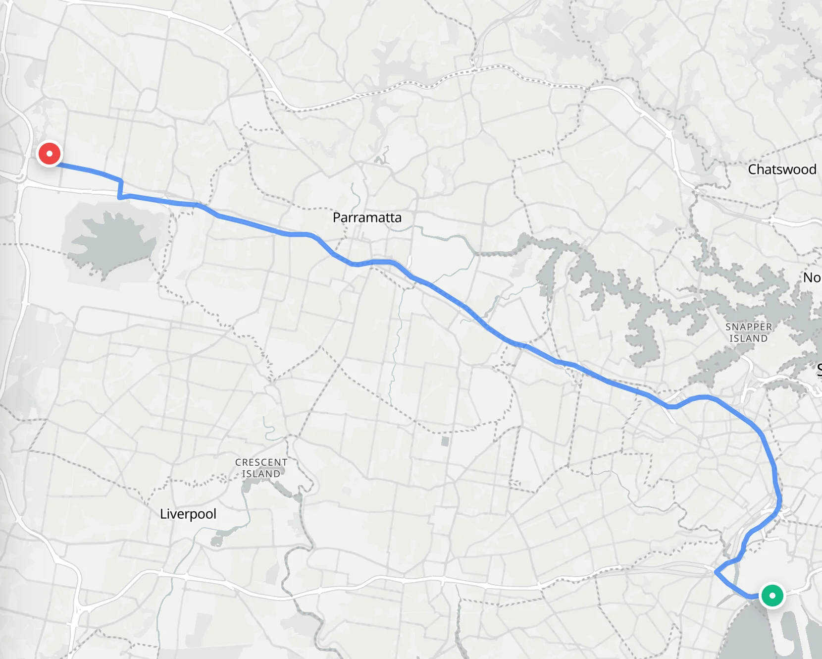
The map is sent as vector tiles built from OpenStreetMap, in a light style and a dark style. The rider app, the driver app and the web booking page all draw it with MapLibre, so the same streets look the same on every screen.
Vector tiles stay sharp at every zoom. On iOS the server can also draw the tiles as images, as a fallback.
What this gives the operator
- No Google Maps API bill
- Address search, route quotes and map display are answered by the operator's own server, however many bookings come in.
- Addresses stay in house
- Every pickup and drop-off a rider types is looked up on the operator's own server.
- Its own places on the map
- The operator adds the depots, bays and new estates its drivers need, without waiting for a map provider.
- A way back
- The apps choose their map provider with one setting, so Google Maps stays available as a fallback.
Maps were one part of the platform
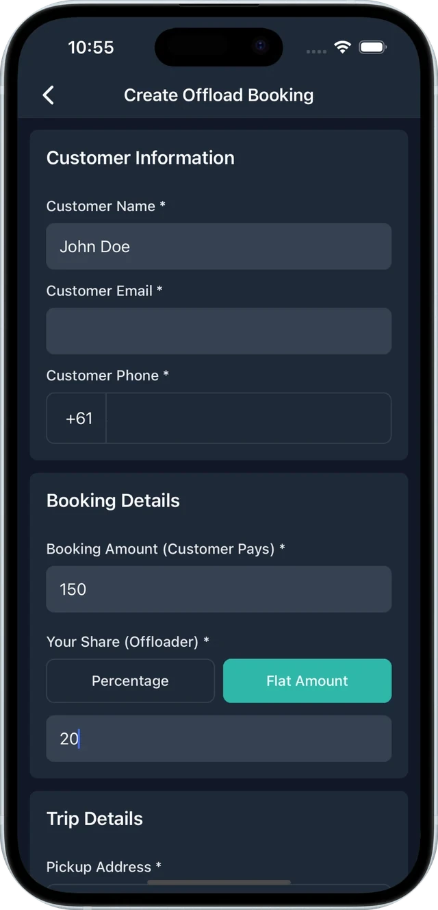
- Job offload. A driver passes a booking to another driver and sets the share to keep.
- Corporate booking for hotels and institutions.
- Payments through Stripe and Square.
- Dispatch rules that can send jobs to premium drivers first, or rank drivers by score.
- A booking desk for phone and web-form bookings, with support tickets and live chat.
- In-app voice calls between rider and driver, with no personal number shown.
The same gateway in other countries
Nothing in the gateway is tied to Australia. It loads whichever national address file it is given, and where a country has none it searches OpenStreetMap. The same gateway also runs our New Zealand maps, from that country's national address data, and our Malaysian maps, from OpenStreetMap.
See how self-hosted maps work on every Exicube platform →
Map data © OpenStreetMap contributors. Map tiles © OpenMapTiles. Incorporates or developed using G-NAF © Geoscape Australia licensed by the Commonwealth of Australia under the Open Geo-coded National Address File (G-NAF) End User Licence Agreement. Screens are from the Rigzie rider app, the Rigzie driver app and the web booking page.
See how Exicube can work for you
Launch your ride-hailing business on the same managed platform.